

Hanover Area History
East Hanover  (Click here for Map)
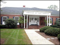
East Hanover was Incorporated in 1928 and covers an area of 8.2 square miles. It is 25 miles west of New York. The Passaic River is on its Eastern border and the Whippany River is on its Western side. Parsippany, Troy Hills, Florham Park, Hanover Township (Whippany), Roseland, Livingston and Montville are the municipalities adjacent to East Hanover. Routes 10 and 280 are major arteries which pass through East Hanover with Eagle Rock Avenue feeding from Roseland and Columbia Turnpike close by in Florham Park.
Largely developed, East Hanover is proud of such major corporations as Novartis and Nabisco in addition to more than 2100 other business enterprises operating in industrial parks, contemporary office complexes and retail stores. Route 10 is becoming one of the finest shopping areas in New Jersey.
Mount Pleasant Avenue contains a historical district, which has been placed in the Congressional Record. The First Presbyterian Church and its adjoining graveyard date back to the Revolutionary War. Many American Indian artifacts have been discovered in various parts of East Hanover.
East Hanover has township form of government with a Mayor and four Council members who are directly elected by the voters. The mayor is Chief Executive Officer of the Township and participates and presides over the meetings of the council.
Florham Park (Click here for Map)
The Borough of Florham Park is located in the South Eastern part of Morris County and is bordered on the South by Madison and Chatham Boroughs; on the North by Hanover and East Hanover Townships; on the West by Morris Township; and on the East by the Passaic River.
The area was first settled by the English sometime between 1680 and 1700, being recognized as a prime farming area. In 1817 it was bisected by the Newark and Morris Turnpike (State Highway #510) which brought an influx of residents and businesses, including the making of whiskey and bricks, as well as the broom industry which gave Florham Park it's nickname of Broomtown.
Florham Park was incorporated by the State Assembly on March 20, 1899, and operates under a Borough form of government. The Mayor and six Councilmen, all elected at large, serve without pay and constitute the Borough Council.
Once the site of two major estates, one now a private golf club and the other a suburban campus of Fairleigh Dickinson University, the 7.6 square mile Borough provides a large municipal recreation area, a private golf course and a public golf course; one municipal swim club; numerous businesses; professional office buildings; light industry and residential development. Subdivisions with split level, ranch and colonial type homes, and four condominium complexes house over 8,521 people in approximately 2,400 homes (mostly owner occupied). Many civic and social organizations, as well as five places of worship, help create the friendly atmosphere which is characteristic of Florham Park.
Hanover Township (Click here for Map)
Hanover Township, encompassing 10.8 square miles of Morris County, was settled in 1676 and Incorporated on March 25, 1740. The Township, comprised of Cedar Knolls and Whippany, is currently home to more than 12,000 residents. It is a suburban community with a mixture of single family homes, townhouses and apartments, small businesses, commercial buildings and industrial facilities.
Located approximately 45-minutes southwest of New York City; at the cross roads of Interstate Route 287, State Route 24, and Route 10, it is bordered by Morris, Parsippany-Troy Hills, East Hanover, Morris Plains and Florham Park. It has a Township form of government with a five member Committee, including the mayor.
Morristown Airport, the third largest airport in the state, is located in the Township. Some of the more prominent businesses in Hanover Township include Lucent Technologies, Knoll Pharmaceutical, Bell Atlantic and Bear Stearns.